2020/11/20 – 2020/11/22
From my desk on the tenth floor of my office in Atsugi, Japan I can see the mountains in western Kanagawa Prefecture. I find looking at the mountains to be soothing. When work gets a bit stressful I walk over to the window and look at the mountains for a minute or two. In addition to being soothing, looking at the mountains makes me feel a little restless. The nearest mountain to my window view is Mt. Oyama. (It is kind of redundant to say Mt. Oyama as “yama” means mountain in Japanese. It is like saying Mt. O Mountain, or maybe mountain, oh, mountain.) The optical illusion caused by big objects make it look like Oyama is just an arm’s reach away. In reality it is about 10 plus kilometer away. There is campground called Fureainomori Hinata Camping Ground midway up its eastern slope. For months I have been wanting to ride from the office to Oyama. Being about 10k from the office it should be an easy thing to ride there after work and pitch my tent.
Despite its nearness I wasn’t able to make the trip during the warmer months because of my busy schedule at work. But in October, under pressure from HR to take some time off, I made a plan to load up the Surly Blue Beast with my gear and ride from home to the office in the morning then ride from the office to camp ground after work. The idea was that I would spend the night at the campground on Oyama then on the next day ride to Atami and stealth camp on the beach. Then ride home on the third day. The third day would be about 100 kilometers. That was the plan. As you will see, plans change
Day 1 A Late Start (20 Oct.)
I had a meeting at 10:30 in the morning but I got off to a late start. I realized about 10 or so kilometers into the ride that I might not be able to get the office in time for the meeting. So discretion being the better part of valor I decided to ride to Machida and hop on the train from there. I left my fully loaded bicycle at the public lot near the station and rode the Odakyu line to Hon-Atsugi. From Hon-Atsugi Station I did as usual and rode Baby Blue, my mini-velo which I keep at Hon-Atsugi, the 2 plus kilometers to the office. I worked a full day as planned, actually I didn’t leave the office until at least 8 p.m. Another late start. I rode Baby Blue back to Hon-Atsugi, took the train back to Machida Station. I ate dinner (curry rice) near the station and returned to where Mad Max, the Surly Blue Beast, was parked to continue my trip. By the time I left Machida it was about 11 p.m. I didn’t get to the campground until 2:30 a.m.
Normally, I wouldn’t want to arrive at a campground I am not familiar with after dark but in this case it was unavoidable. I had no idea what Fureainomori Hinata Campground was going to be like. I didn’t even know if it would be open or not. There was no contact number. It seems like the only way to make a reservation was by contacting the Isehara City Office. I didn’t do that. I suspected it wouldn’t be open and I was correct. I had the entire campground to myself. The downside to this was that the gate at the base of driveway leading up to the campground was locked and I had to push my bike around it through the weeds. The other downside is that the toilets were locked and the water was turned off.
In the dark I couldn’t find any flat places to pitch a tent. All I could see were bungalows built on the steep slope leading further up the mountain. It was a lot of work pushing the bike up the very steep driveway to the camp area. I was quite warm from the hard ride/push up the mountain and the push up the driveway. I thought I could do without putting up the tent. I blew up my air mattress and spread it and my sleeping bag out on a low picnic table. It was a chilly night once I cooled down from my efforts. I probably should have put up the tent but I survived well enough without it.
Day 2 From the Sky to the Sea (21 Oct.)
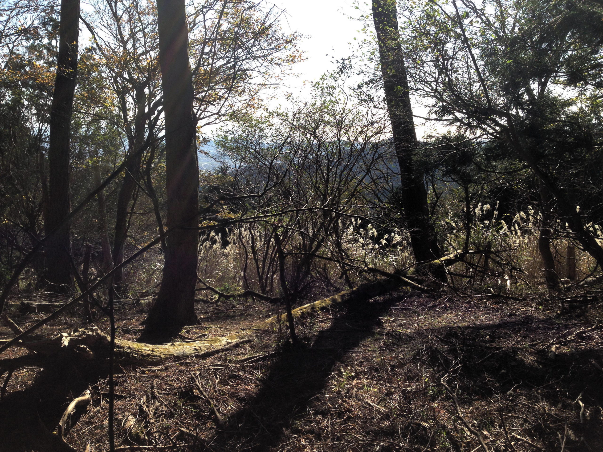
In the light of morning I could take better stock of my situation. It is clear the campground was closed for the season. It was in obvious need of some annual clean up and repair. While I ate my breakfast I decided that it would be a shame to come this far and not do some hiking so I scrapped my plan to go to Atami and decided to hike up to the observation point higher up Oyama. The sign said it was only 2 km to the observation point (not the summit, that was still farther up). It was a rough hike following a trail that switched back and forth up the steep slope. It seems like it is a popular place to hike, probably due to the campground, because the trail was well maintained. It wasn’t so steep that I had to use my hands to climb but it still took me over an hour and a half to reach my goal. As I neared my destination I met other hikers coming down. I expected the observation point to be like the campground, mostly, if not completely, empty of people, but to my surprise there was a small crowd sitting at a dozen or so picnic tables. The hikers ranged in age from elementary school aged children to grandmas and grandpas. I regretted not bringing some food with me to eat a picnic lunch overlooking the city of Isehara far below. In fact, I came up the mountain empty-handed. I didn’t even bring water. Fortunately, it was late fall and I wasn’t sweating much at all.
Part way up I caught a beautiful view of the ocean to the south and decided that even though I had scrapped my plan for Atami that I would still try to go to the ocean. The hike down the mountain was much quicker but harder on the knees. I was happy to reach the campsite and found that my gear which I had packed up but left out on the picnic table and my bicycle were undisturbed. After loading up my bicycle I ate lunch and planned the rest of the day. I found a campground right on the shoreline in Chigasaki at the mouth of the Sagami River. It was only about 25 km away which was good because I used up half the day hiking on the mountain and it would begin getting dark around 5:30 p.m.
I flew down the mountain road that I had to push my bike up the night before. I was seeing it all for the first time. Indeed, without any street lighting I only saw the narrow tunnel illuminated by my headlight. I couldn’t really give the Blue Beast his head because the road was narrow and very winding. I braked frequently to keep my speed at a safe level. Still, it was an invigorating ride. Perhaps the highlight of the day was after I crossed the Sagami River at Ichinomiya and was treated to a view of Mt. Fuji at sunset. The mountain rose above the city of Hiratsuka against an orange sky with its middle heights shrouded in clouds.
I rolled into Yanagishima Camping Ground around 4:30 p.m. The difference between the campground on Oyama and Yanagishima was like night and day. For one, Yanagishima was open for business and business was booming. When I checked in there were only a few camping spaces available. Second, I checked in proper and paid the 3,800 yen fee to put up my tent. Yanagishima is like a nice hotel where you have to bring your own room but everything else is provided. It is very strictly managed. I was assigned a picnic table in the picnic area and was advised that no open flames or fireworks were allowed in the camping areas and lights out was at 9 p.m. The nice thing about this campground is that it had a very nice shower facility with hot water. I was happy to take advantage of the shower. I was surprised that no one else was using the showers. I suppose, since most people were “car” camping for only one night there isn’t that much demand for showers. Well, I sure appreciated washing off the sweat of two days of riding and hiking.
Day 3 Homeward Bound (22 Oct.)
Since I completely changed my plans the day before I had to make a new plan for my third and final day of riding. I suppose, I could have taken another day as the following day was a national holiday but I promised that I would be back home by Sunday evening. My thought was to follow the Sagami River upstream to Sagamiko Park on the shores of Lake Sagami where I could eat lunch but first I wanted to actually see the ocean. It turns out that I was camped only a few hundred meters from the beach. Just far enough to be out of earshot of the sound of the surf. In fact, if the campground had been full I could have camped on the beach. I found a bicycle path that paralleled the beach for a little bit and enjoyed the ocean vistas as I pedaled for the mouth of the river. In the future, I think would be nice to return here and spend more time on the beach and in the park nearby.
I headed up the Sagami River through the city of Chigasaki. Chigasaki is not, in my opinion, a pretty city. It seems to be a manufacturing town but I did see some very interesting sights along the way. I spent a few minutes to watch a marching band practice in a riverside park. But before that, the most unusual sight was a pair of engine-powered paragliders that were circling back and forth over the river. It was quite windy but fortunately for me the wind was to my back for most of the trip. The paragliders would push very slowly against the wind then turn around and soar at speed with the wind to their backs then turn around and repeat. I didn’t expect to see paragliders in the middle of the city.
The other interesting site, though not rare, was a man sitting on the back of his car playing the saxophone. As many people live in apartments and must live quietly out respect and politeness to their neighbors residents with a musical bend are forced to find other places to practice. It is not unusual to see someone practice the trumpet, saxophone or other hearty instrument in some out of the way corner of a park. Some people get annoyed by it and instruments are prohibited in some city parks but I don’t mind at all.
As I said, the plan was to go to Sagamiko but it became clear I would run out of time. I didn’t really map out the route. The general idea was to follow the river as much as I could. I was hoping that would keep me in the lowlands. At some point, my route diverged from the river bank. Partly because I wanted to avoid major roads and partly because I was looking for a more direct route. I found myself riding through some foothills south and southeast of Sagamiko. Lake Sagami (Sagamiko) was formed by damming the Sagami River so the water backs up behind the dam and files the valley which is formed by low but very steep mountains. The major roads try to find the lowest passes over the mountains and keep the grade under 8% but the lesser traveled roads don’t feel any obligation to follow such rules. Though not marked I found myself climbing slopes of 10% or more. I was certain that I would have to push my bicycle as I had on the first night. To my surprise, I managed, with frequent rest stops, to pedal all the way.
At one point I checked the map and I was shocked to see that the red line that represented my track had separated significantly from the blue line of my intended route. I didn’t see any turnoffs along the way so I don’t know how I got off course. It was a bit discouraging because I had just finished a particularly steep section of road. The map didn’t even show a road. I decided to continue on and not go back. Hopefully, the road I was on would rejoin my intended route. In the end, I got where I needed to go. Maybe it was just a bad GPS signal.
Lost and Found
Unfortunately, somewhere on those hilly roads I dropped the iPhone 5c that I use as a camera. (Believe it or not, most of the video I use for my YouTube features are taken with a 5c.) I noticed it near the top with most of the climbing behind me. For a number of reasons, I was very upset when I realized the phone was missing. First and foremost, is the loss of memories that are represented by the photos and videos that I had taken. Another reason is that backtracking to look for the phone meant retracing my steps and going up again the steep inclines I had just conquered. I thought about just writing off the loss but the idea of returning home without any pictures or videos was too much to bear. There was nothing for it. I turned my bike around and headed back up the hills I just come down. When I went well past where I remembered taking the last photo and not seeing any sign of it I started to berate myself for not attaching any kind of ID onto the phone. I turned around and headed back up climb again. I got nearly to the point where I noticed the phone was missing without finding the phone. I refused to give up. I turned around a second time and headed back down the road. When had almost reached the bottom of the climb I gave up hope of finding the phone. By this time, I had wasted at least an hour or more looking for it and I was getting tired of this stretch of road and tired of climbing. I figured, I properly pedaled up the incline the first time there is no reason I have to do it again so in the particularly steep parts I got off and pushed my bike. It turns out this was a good choice. Taking the route at a walking speed without my attention being divided between keeping the cranks turning and keeping my balance I had more time to look for the phone. And I found it! In fact, it wasn’t too far from where I noticed it was missing. Before my next trip I am going to make some changes to make losing my camera phone more difficult and easier to find.
The remainder of the climb was as pleasant as steep roads can be, but like I said before, I was nearly at the end of the climb. Near the top I spotted two hunters. The first told me that he was hunting deer. This is the first time I have ever met any hunters on my travels in Japan. Owning a firearm is very rare and tightly regulated in Japan. My conversation with the hunter probably scared off the deer. In the U.S. where deer populations are out of control in many places I would feel a little bad about ruining a hunter’s stakeout but not in Japan. Deer are rarely spotted in Japan and not a problem so I don’t see as much need to control their population. Anyway, I’m glad the hunters didn’t mistake me and the Blue Beast for Bamboo and take a shot at me.
I lost a lot of time with all of this back and forth, up and down. It became clear that I wasn’t going to make it to Sagamiko before night fall. I don’t mind riding at night, particularly when I am riding on familiar roads but I didn’t want to get home too late. It seemed prudent to cut Sagamiko out of my route. When I came out of the steep hills (there were still lesser hills ahead) I turned my wheels toward home.
Lessons Learned
1. Make sure your camera/phone is securely in your pocket or bike bag.
2. Write your name and contact information on all your valuable gear to improve the chances of it returning to you if you should happen to lose it.
3. If you are going take a wrong turn or don’t know which way to go at a fork in the road, error on the uphill side. At least, that way, if you have to retrace your route you get to go downhill.
4. Be flexible. Things happen and plans can and will fall apart. If you are willing to go with the flow you can still have a great tour even if things don’t go as planned.
5. If you are going to ride at night, buy a good headlight and taillight.
Video
[yotuwp type=”videos” id=”GJiv77vvvkA” ]
Photo Gallery


2019/06/15
The journey ends. Today was the last day of the trip. I am my fellow wayfarers rode from Muscoda to Prairie du Chien. A ride of just 44 miles. The route was mostly flat with a few long, gradual climbs, finishing with a long descent into Prairie du Chien. It was a bit warmer today so I worked up a little bit of a sweat. The only downside to the ride really were the gnats. Anytime I stopped for any reasons they swarmed around me. They got in my nose, my mouth and my ears. When I slowed down to go up a hill they caught up to me. With almost every gasp I took in another gnat. I don’t know what they were after. They didn’t bite or sting. They just bothered. Perhaps they were looking for a place to lay their eggs.
I left as early as I could manage from Muscoda with the thought that I would finish off the ride by crossing the Mississippi River just a mile or two away so I could brag that I road from the Upper Peninsula of Michigan all the way to Iowa. Unfortunately, I took a wrong turn and added another 6 miles to journey and fell behind most everyone. Since I had arranged for a ride to Elkhorn I didn’t want to keep the gentleman waiting another 30 minutes or more while I indulged myself.
There were quite a few others who left after me including Dennis and Nanette, my companions of the road during the rainy and windy days. I fully expected others to pass me up as I stopped for pictures and videos. As I rode along I wondered where everyone was. They should have passed me by now. I got to the top of fairly big hill and looked back over the ground I had covered and there was no one following me. This was definitely not right. I checked my map for the first time today. I was quite a bit off course and the only way to get back on course was to backtrack 3 miles. It was an easy ride back as it was mostly downhill.
On the last leg of the trip 3 ladies caught up to. They were moving at a good pace and chatting most of the time. I wasn’t sure I could match their pace the remaining 8 or 9 miles to Prairie du Chien. One of them told me she had ridden GRABAAWR about 20 times. Very impressive. I did pull ahead of them only because they stopped to adjust something on one of their bikes. They did eventually catch up to me on top to the long descent into town. By then, we all slowed our pace. For my part, I wanted to delay the end just a little bit and finish with someone instead of alone.
When I passed the Prairie du Chien sign I thought, “So this is the end. I could keep going.” and “I am not ready for this to end.” I was anxious for it to end so that I could tell other people about how much fun I had and the really great people I met but I didn’t want the experience to be over yet. I wanted the adventure to continue.
Thoughts on Supported Rides and Groups
There are significant differences between supported rides and unsupported rides other than the obvious differences of paying someone to all haul your gear. Because it is unsupported you are riding with and adjacent to other people. You still have the option of riding alone by leaving earlier or later than everyone else but you can also find someone who matches your pace. The downside of riding with a group is that it is harder to stop and start when you want to because you are participating in the group dynamic. On days when I was riding with others I didn’t take as many photos and videos. The upside is that you have companionship and support from your fellow riders. Good companions make the miles fly by and the hills smaller. It is a proven fact that a shared hardship is less hard for the sparing.
Differences
This entire tour was different from my tours up until. Besides the obvious differences of riding in a group vs. riding alone and riding in the U.S. and riding in Japan, there were some significant differences. One big difference being the distances. On my own I would probably limit my daily distance to between 20 to 40 miles. Compared to the century of the first day these are really short distances. In this ride I proved to myself that I can do longer distances even over consecutive days. The key is to rest when you need to. There is no need to be macho and try to tough it out. As I often ride during spring and fall when the days are shorter, shorter distances are practical. Plus, I like to stop to take photos and videos. Another big difference is that we were really riding in the countryside (Inaka). There wasn’t a convenience store or gasoline station every few hundred meters. Doing this same route would take more carefully planning in terms of water. In Japan, every school and nearly every park will have water available. Even in the outskirts and suburbs of Tokyo water can be obtained fairly easily. Further out in the countryside it is probably a different situation. The road conditions varied from freshly paved to in desperate need of re-paving. This is probably similar to Japan. Perhaps, pavement conditions are bit better in Japan. Traffic got heavier and heavier the further southwest we went with the last day being the worst (yet still tolerable). When I was traveling in Chiba (particularly in Chiba) and around Mt. Fuji even the country roads had more traffic. This is due, in part, to the terrain. The land is mountainous and the only place to build a road is in the valleys and over the passes. Despite the countryside in Japan being sparsely populated the population is concentrated in the valleys. Alternate routes are far and few between. Perhaps traffic conditions are better farther away from Tokyo. One final word on the topic of roads, roads in Wisconsin are wider. For the most part, even on heavily trafficked roads there is an abundance of space both on the shoulder and in the driving lane. Most of the time, drivers have little excuse for not giving pedestrians and bicycle riders a wide berth when they pass.
Lessons Learned
I mostly packed with traveling by train and plane in mind and only carried what I could easily carry in my hands without a bulky suitcase and I also packed as it I was going on an unsupported tour. Since I don’t have to haul my own gear and food was provided for me I could have left the trail mix at home. Sleeping indoors in the school gym or church was available I could have left the tent at home as well. (I preferred the privacy of my on tent.) Instead, I could have brought more clothes. Regardless, of whether the tour was supported or unsupported I should have brought some rope or parachord to use as a clothesline. Also, I need to get a new air mattress. My mattress sprung some more leaks despite patching it. By morning it was completely flat. I threw it out the morning I left Muscoda.
Recommendations and Advice
1. Whatever bike you are riding, make sure you are comfortable riding it and it is tuned up professionally before the event.
2. Make sure you have plenty of water. (Good advice no matter how you roll.)
3. Have a bike bag of some kind either on your handlebars or on a rack to carry essential items like sunscreen, a small toolkit, camera, batteries, snacks, rain gear, etc.
4. Pack better. Since this was a completely supported trip I shouldn’t have bothered trying to pack like I was on my own. There was no reason to pack everything in my panniers since I wasn’t going to be mounting them on a rack. A big suitcase would have been a better choice.
5. I can do long distances if I want to/have to. Even a hundred miles a day is not out of reach. But I also learned, or maybe relearned is more accurate, that I would rather spend more time in the towns that I stayed in. There is a lot of local color that I missed out on because I didn’t spend enough time in the places that I passed through.
6. Have fun. I had plenty of fun. Type I and Type II.
The Final Word
Would I do this ride or one like it again? If the opportunity presents itself and time and budget allow, definitely, yes. I would recommend it even to season unsupported bicycle tourists. It is encouraging to meet like-minded people and share an experience with them. On surface it may seem expensive, especially to younger people. But what you get in return for the money is well worth the price of participation.
Photo Gallery


Video
[yotuwp type=”videos” id=”RzTzr6-WD7Q” ]
Home | Photo Gallery | Podcasts | Videos
]]>2019/06/14
Today can be considered a Type II Day. A very strong wind blew against us all day long. It was unrelenting. At least, it was not accompanied by rain or uncomfortable temperatures. I got lost twice.
The route today was from Baraboo to Muscoda with a 3 mile option to loop around Devil’s Lake. Ahead of me I could see a couple and a rode with my new friends for most of the day. I was following an older gentleman that I met the day before named Bob, at the Baraboo lodging. In my opinion, an extraordinary fellow. He has been doing long bicycle touring since his retirement some 20 plus years before. Today, he was quite some way ahead of me but I could still see him on the straight stretches of roads. I was gradually gaining on him because he would stop briefly at intersections to confirm the cue sheet. (He rides completely without a GPS or smart phone. He only uses a rudimentary bicycle computer.) We went down a long slope until I caught up to him at a roundabout. We were both were wondering which way to go because there were route markets on the pavement. Finally, I looked at the map and realized we had not only missed our turn but had backtracked almost all the way to where we started in Baraboo. So we turned around and headed back up the hill. We finally got back on track. The place to turn wasn’t as well marked as it could have been. If we had been following the cue sheet more closely or the map on my phone we wouldn’t have missed the turn.
The loop around Devil’s Lake. I don’t know history of the name but I saw nothing of the devil in the place. It is a beautiful lake surrounded by rocky bluffs. We had a few steep climbs and winding descents along the way but views were well worth the detour. I rode with Bob for the rest of the day. I liked his attitude about touring. It didn’t matter how slow we went. So long as we got to the end of the day’s ride before the tavern closed he was happy to go any pace and take breaks along the way. Riding the heavier bike I found his pace (and attitude) perfectly suited me. At the first rest stop we met up with Dennis and Nanette, a lovely I couple from Rhinelander. We rode with them the for the rest of the day. They, too, were on mountain bikes so tended to set a slightly slower pace.
From the first rest stop our struggle against the wind began in earnest. It was blowing from the southwest which was the direction we were going in. The first rest area was a quaint, old-fashioned church in the village of Blackhawk. Rested up and refueled with bananas and Fig Newtons, we set out. Not more than a few minutes after leaving the rest stop we spotted a route marker from the previous year pointing to the right. Dennis was leading out our little peloton and turned right. I was riding next to his wife Nanette and she suggested that that we go straight because there was no new route marker but until now last year’s route and this route had not differed at all so we continued on. We went on for several miles blissfully ignorant of our error until we met another couple coming from the opposite direction who informed us that we were going the wrong way. I loaded up a new map and sure enough we were off course again. We turned around and backtracked almost all the way to the rest stop. That was the fastest average speed we achieved all day. The fierce wind that was like an invisible hand dragging us back was suddenly pushing us forward. I felt like I had a sail strapped to my back.
Back on course we turned back into the wind. The wind was either blowing into our face or pushing at our left side. When it was coming at us from front and left we had to compensate for the resistance by leaning slightly to the left. How much a strong side wind impacted us became very clear when a semi-truck passed us from behind. The sudden blocking of the wind combined with sucking of the truck’s slipstream had the effect of jerking us momentarily into the road. It happened in an instant and was over just as quick when the truck was gone and the wind pushing us toward the shoulder. The combined affect was that we were buffeted first left then right.
As we got closer to Muscoda the roads got straighter and the terrain less hilly. If not for the wind we would have made excellent time. It would have been easy pedaling. I have to say, I like winding and slightly hilly roads better. Long, straight roads get a bit monotonous. Even when we were not talking just the presence or others nearby made the experience more tolerable.
All in all, this was the hardest day of the whole tour. Fortunately, I had recovered physically from my bouncing Century on the first day. While I have no desire to repeat this day and maintain that the best way to ride in the wind or rain is to not ride at all, I am glad I did it.
Photo Gallery


2019/06/13
Mauston to Baraboo. A truly perfect day on the bike. Today was a short day with only 73 km (44 miles) of riding. The route was a good combination of hills and flats. I had several plans for activities once I got to Baraboo so I didn’t want to dilly dally along the way. Despite this desire I still ended up making frequent stops to take photos and videos. I couldn’t resist. The first rest stop was Lyndon Station. I decided to pass by without stopping if I was feeling good. I breezed by the rest stop with every intention of stopping at the second rest stop. I got in the zone and didn’t notice the marks for the rest stop. As a result, I pulled into Baraboo shortly after 12 noon.
Perhaps, the highlight of the day was seeing two Sandhill Cranes with two baby cranes in tow. It was the first time for me to see this type of bird. I also spotted what I think were wild turkeys crossing the road. I am not sure because they were so far off in the distance I couldn’t see any details. When I asked some of the local Wisconsin riders they said there were turkeys in Wisconsin. There may have event been fledglings following I though, if not turkeys, perhaps pheasant but now that I consider it some more I might have seen more cranes. In the absence of confirmation I am going with my first guess of wild turkeys.
I saw more cows than any other day but still not as many as I expected. Maybe there are more cows further south.
I feel like I am finally hitting my stride. My knee was hurting on previous days but it has been getting better little by little. Today it just a little uncomfortable. Additionally, I am getting used to the bicycle. While I would not buy this kind of bicycle I am beginning to make it work for me. It certainly has its advantages in some circumstances such as wet pavement, bumpy ro unsaved roads. I can go where the skinny tire gang fear to go. There aren’t too many places like that on this route.
I started out early this morning in order to finish earlier. Despite starting earlier may people passed me up. I don’t mind. It was a good opportunity to take pictures of other riders besides myself. Everyone was so nice as they passed me up. Many people asked me if I was alright even though I though it was obvious that I had just stopped to take a picture. Still, the gesture was appreciated.
Baraboo has a very “Americana” feel to the town. I walked around the downtown area a little bit while looking for a place to eat. All the store front around the square are in that traditional late 1800’s early 1900’s style. Of course, Baraboo is famous for the Ringling Brothers Circus. There is a museum, a theater and, of course, Circus World, a locally running circus. I am in the town square listening to a brass band playing early 20th century marching tunes and eating a bratwurst.
A word about my plans for Baraboo. I had made arrangement weeks in advance to meat an old friend from elementary school. She drove up from Stoughton and we had dinner together. In addition to that, I wanted to interview Rob Layton, the owner/operator of Bike Wisconsin and GRABAAWR for the Pedalshift Project Podcast. Rob is a busy guy but this short day was a good opportunity to talk with him.
My take away from this beautiful day of riding is that no matter what you do, Ride Your Own Ride.
Photo Gallery


Video
[yotuwp type=”videos” id=”RzTzr6-WD7Q” ]
Home | Photo Gallery | Podcasts | Videos
]]>2019/06/12
Today was a Type II fun day. It rained almost the entire time I was riding. It cleared up for the last 12 miles (25 km) of the ride to just dump down rain when I was less than 10 minutes from the lodging area. On top of all that my Frog Toggs rain gear was a complete failure. It held up for an hour or two but eventually the water started seeping through. By the time I was well into the ride my clothes were soaked. Additionally, the pants ripped wide open at the inseam when they get caught on the seat when I got on the bike. I can’t say that I recommend Frog Toggs rain gear. Sorry Kermit.
Despite the rain I had a great ride. The terrain was very flat. We rode through a mix of farmland and swamps. There was a long section of road that passed through the township of Armenia that was absolutely my favorite. The swamps and forest encroach right onto the road. Other than the road itself and the rare house, there isn’t a single sign of human habitation. I could ride that stretch of road every day and never get tired of it. I wouldn’t stop much though because as soon as you do the mosquitos attack.
In the afternoon I joined up with a retired couple from Rhinelander. They set a nice steady pace that I could keep up with and we cover ground steadily. I didn’t stop to take any pictures in the afternoon but I took plenty of pictures in the morning despite the rain. Waterproof cases for my cameras paid off. My iPhone 8 plus, the iPhone 6 and 5c. Were exposed to the rain for hours and they are all still very functional. Unfortunately, touch screens are very difficult to use when your fingers and the screen get wet. It was almost impossible to unlock my iPhone 8 plus because the fingerprint sensor didn’t recognize my touch as a finger at all. It made it impossible to use the maps. Of course, because of the rain I didn’t want to take out the cue sheets. I should have put them in a zip-lock bag.
I saw very little wildlife. The rain had probably forced them all to take refuge, each according to its species. I saw less roadkill today as well. I wonder if that is an indication that there is less wildlife in the area to tangle with humans or fewer humans. In general, this are seems more populous than farther north so I think the former is more likely. I did rescue a turtle we found on the road. It was a fairly large and heavy critter. About the size of two fists. I picked it up and moved it to the grass on the other side of the road. We assumed it was trying to get to the other side but there is no assurance that that was its actual intentions. No man knows the mind of a turtle.
As I mentioned, the last 25 km the rain stopped. I had almost dried out by the time we rolled into Mauston. We could see some ugly black clouds rolling. We hoped we could reach the lodging before the rain came. Our hopes were dashed to the ground with the rain drops. Just as we passed under an overpass a heavy rain started to come down. The weather went from a few isolated drops of water to deluge in less than a minute. If we had been smart we should have waited out the storm under the overpass but we weren’t. Maybe after riding all morning and most of the afternoon more rain didn’t seem to manner. We forged on. The rain was coming down so heavily we couldn’t clearly see the route marks on the road. The gentleman I was riding with spotted a school zone sign so we turned in that direction but it was the wrong school. Next to the wrong school was the Mauston Police Station. We went in there to ask directions. We weren’t far from our final destination. By the time we had our directions the rain had stopped. The storm came and went all within the space of 10 minutes.
Photo Gallery


GRABAAWR Video
[yotuwp type=”videos” id=”RzTzr6-WD7Q” ]
Home | Photo Gallery | Podcasts | Videos
]]>2019/06/11
Today I rode from Wausau to Wisconsin Rapids. A total of 64 miles or 119 km. I missed breakfast at the church where they were serving it so I and a father and son duo from Missouri headed out of town and stopped at a store on the way. That was actually better because I was able to get some hot gas station food that tasted pretty good under the circumstances.
The route today included a detour up Rib Mountain. To be honest, I think calling it a mountain is wishful thinking. It is more like a big hill than a mountain. But, for Wisconsin, it is the closest thing to a mountain that the state has. At the turn off point for Rib Mountain I looked at the elevation profile and saw that there was only 250 meters of climbing spread out over 3 or 4 km. It didn’t look that bad to me. But aI decided that the better part of valor was discretion and bypassed the mountain. Later, a woman who completed the detour said the grade was 9%. That is significant.
I made good time today. I reach each rest stop with time to spare. After the third rest stop I got caught in the rain again. This time I was more prepared. I brought my rain gear. I also jerry-rigged a cover more my phone so that I could leave it on my handlebars and still see while keeping it dry for the most part. The rain let up quickly and I was able to continue on. I pleased with my impromptu phone cover and my foresight to bring my raincoat with. All in all, it was a good day.
The forecast is for rain all night and day so I made the decision to sleep in the gym. I unfolded my tent to give it a chance to dry out. After I got cleaned up I took the shuttle bus into town where I did my laundry and got dinner at Arby’s. Afterwards, I popped into the Dollar Tree and bought a pair of flip flops and a small inflatable kick board. The most bizarre thing was calling up the shuttle driver to be picked up by a big yellow school bus on demand. It seemed impractical to operate a large school bus just to pick up one person but that is what happened. If I wasn’t so tired I could have easily ridden my bicycle the short distance to town.
Photo Gallery


Video
[yotuwp type=”videos” id=”RzTzr6-WD7Q” ]
Home | Photo Gallery | Podcasts | Videos
]]>2019/06/10
Day 2: Rhinelander to Wausau
The event mechanic, Jorge, tightened up the suspension on Bouncing Bettie so it was much easier to ride. I was able to use the granny gear which made all of the hills much easier to climb. I only walked up one hill but more on that later.
They day started out chilly and windy but soon warmed up. I was the last person to leave the camp because it took me a while to pack up my wet gear and because I chatted with Jorge for a bit.
The route was excellent to just like on day 1. There were a few more busy streets but all very manageable. There was significantly more climbing today and more descending. The data shows that the climbs were steeper too. There was at least one 7% grade. I knew before I got to the top that it was at least 7% based on past experience. Given the distance it was not any worse than some of my past trips.
The distance was 131 km (83) miles. Far shorter than the previous day of 165 km (100) miles. Even so, It took me about the same amount of time in the saddle as day 1. I attribute this to a couple of factors. One, there was more climbing. Nearly 850 meters. And the second, related to the first, my average speed on day 1 was 19.5 kph where on day 2 it was only the 15.7 kph. Additionally, my right hamstring, below the knee, was starting to hurt. I believe that it is because I really overdid it on day 1. On day 1 I was trying to match the pace of the couple I was riding with. Given the condition of the bicycle that was very impractical. All the strain and occasional bouncing was too much for my previously injured leg.
Today I set out to ride my own ride. I stopped frequently to take pictures and video and to enjoy nature. And enjoy it I did. More so than Say 1 I was caught up in all the beauty of my surroundings, man made and natural. There was a place about 6 miles out of the village of Harris that just captivated me. The road cut through a wetland that begged me to take pictures. I started by wanted to get video of my descending a long hill as I came into the wetland. The clouds above the water were very dramatic so I killed about 15 minutes trying to get a stop action shot of the clouds scudding across the horizon. Finally, I spotted a turtle on the side of the road that needed investigating. Even with all of the photography breaks I still made it to each rest stop before closing time.
When I was less than 10 miles away I spotted a rain storm blowing in. The weather app confirmed that I was in for a drenching. I tried to outrun the storm but failed. I was not expecting rain before I reached the campsite so I didn’t pack my rain gear. I did have my light yellow riding jacket which I put on. I pulled into someone’s yard to take cover in there tall shrubs while I got the jacket out of the box and stowed by electronics. I pedaled for what seemed like 10 miles but I was still in the outskirts of Wausau. As soon as I pulled off the road to shelter under a carport the rain stopped. I got my phone out to check the map and learned that I STILL had 3 miles to go. By this time my leg was really starting to bother me. In Wausau, I stopped at a Walgreen’s and bought some shippu. Hopefully, that will help.
It is hard to say what the highlight of the day was. There were so many. All day, here and there, premature maple leaves were fluttering down. It is kind of special to ride through a flock (?) of maple seeds. Even during the worst of the rain I experienced it. Many times I wondered how I could capture the amazing technical design of a maple leaf I in a picture or video.
Photo Gallery


Video
[yotuwp type=”videos” id=”RzTzr6-WD7Q” ]
Home | Photo Gallery | Podcasts | Videos
]]>2019/06/09
Today, I think I overdid it a bit. I chose to ride the Century option that goes up to the Upper Peninsula and unofficially to the headwaters of the Wisconsin River. It probably wasn’t a good idea to ride so far on a bike I had never ridden before. I should have taken the 40 mile option. The main problem is that the suspension on the bike is set too loose. Every time I stood up on the pedals or put the bike into the granny gear the bicycle would bounce around like a rabbit or one of those clown bikes you see in a parade or a circus where the hub in the rear wheel is set off center. Every time I turned the cranks the vast majority of my power was bled away by the bounce.
I was nearly the last person to leave the lodging area at Eagle River High School. Perhaps another reason I should have taken the shorter route. The Century route had four rest stops set up about every 20 to 30 miles apart. The base route and the century route diverge about 5 miles after leaving the high school. I decided I would go to the first rest area on the Century route and decide from there whether to continue. I made it to the rest stop in Phelps just at the cut off time. I was the last person to arrive. That should have been a clue to turn back but the run to the border was just another 10 miles there and 10 miles back to the rest stop. I checked my stats so far and saw that I was averaging about 20 km per hour (about 12 mph). The second rest stop was the same location in Phelps. The guy manning the rest stop said he was closing at 11:30. By the time I had rested a bit, refilled my water bottle and fueled up on bananas and grapes, that gave me just barely enough to get back to Phelps.
I set out for the border and the end of the Century route. I had a real sense of being late as I saw all of the other century riders passed by me in the opposite direction as they were returning to Phelps for their second rest stop. I forged on nonetheless.
I was disappointed when I reached the end of the route marked on the map and on the pavement. I didn’t see anything that looked like the headwaters of the Wisconsin River. I was expecting a sign and maybe a little trickle of water coming out of rocky slope or something. I bought a Mellow Yellow at the gas station. My second disappointment. No root beer. What’s this world coming to? I noticed the “Welcome to Michigan” sign North of the route deeper into the U.P. I assumed the headwaters must be somewhere up ahead but I didn’t have time to search for them. So I took some video of the sign and headed back. Oh well. I made to the end of the northern terminus of the route and the U.P.
As I returned to Phelps I was surprised when I spotted two groups of riders ahead of me. A group of 3 that seemed to be going fast and a couple. I felt like I could catch the couple. I would gain on them on the downhill and lose ground at the climbs ultimately never really closing the gap. They were still at the Phelps rest stop when I rolled up.
At the rest stop we figured out how to tighten the suspension on the front fork but there was nothing we could do without tools to tackle the frame suspension. I left the rest stop before the couple did but I was sure that they would catch up to me eventually. And, indeed, they did catch up to me while I stopped to take some video of these cool bigfoot prints that someone had painted crossing the road from the swamp on one side of the road to the swamp on the other side of the road. I thought it was amusing. To be honest, by then I was beginning to feel tire. That section of the road has the steepest hills. On a few occasions I decided I didn’t want to fight the bike and the incline at the same time so walked the bike the last few meters to the crest of a few of the nastier hills. As I always say, there is no shame in walking. To make matters more interesting it began to rain. Not enough to worry about the gear getting wet but enough to remember that I had left my rain gear in the truck.
I caught up to the couple and we rode most of the rest of the trip together. The gentlemen offered me a lot of advice on how to make the ride easier. Much of it were conclusions that I had to come to on my own. But the advice was still appreciated. It was nice of them to babysit me most of the way. We were too slow to make it to the third rest stop at Chain O’ Lakes by the cutoff time. Instead, we stopped at a market in the little community of Three Lakes after about 5 or 6 miles of gravel and chip seal road. The only place where my hefty mountain bike with it’s wide knobby tires and suspension had the advantage over my light weight, skinny tire companions. I didn’t think it was that bad. Most of the time I was thinking my Surly Blue Beast could handle this with no problems. Mad Max is a more versatile bike that the standard road bike or mountain bike. Oh well, you have to ride what you brung.
Nature’s Beauty
There were many beautiful sites along the route. One of the standouts was all of the deer I saw. The first deer allowed me to get very close before it ran away. Up ahead on the road, there was a woman walking her dog. It wasn’t clear at first what she was taking a picture of. At first I thought it might be of myself and several other riders around me. But then, as I approached it became clear she was taking a photo of something across the street. As I approached her I noticed the doe standing in the edge of the woods next to the road. It didn’t seem to be startled at all by our presence.
The other stand out was all of the cotton wood seeds blowing around. It is a lot of fun to ride through a cloud of cottonwood seeds.
The Route
I have to say the route selection was excellent. It was almost entirely back roads with very little traffic. The terrain consisted mostly of rollers. A lot of little ups and downs. The variation made the ride interesting. There was just one stretch of the route after Three Lakes that was on a busier road with long, straight, flat sections. This was some 65 or 70 miles into the route. I have to say, despite being very tired and little sore by then we made excellent time. However, the straightness and the openness was a bit monotonous. Overall, I really enjoyed the rollers. In my head I was calling them roly polys.
All along the route the organizers had marked the pavement with circles with a hash mark indicating direction with paint. For the most part it was very easy to follow. I was wondering if it is legal to paint your own marks on the road. Do you have to get permission to do that?
I finally straggled into the main lodging area at Rhinelander High School at 6 p.m. I left at 7:30 a.m. Minus time for breaks and stopping to take pictures I was in the saddle for 8 hours and 30 minutes. I am not sure that this is the longest time I have spent in the saddle. The trip back from Chiba may have been longer but I think this is perhaps the longest distance I have ridden. I only rode 100 miles. When I consider that endurance racers and brubet riders travel 250 or more kilometers at a crack I am impressed and humbled by their efforts.
I rested a bit then set up my tent. Just as I was getting my gear sorted out the rain came down in buckets. I got most of my gear under cover in time but some of it got wet. The most problematic is my cue sheets for the rest of the week. I sure they will dry but I most handle them carefully until they do. I missed the shuttles into town for dinner because I didn’t feel like leaving the tent in the rain. Surprisingly, I wasn’t really too hungry but I knew I should eat something. I snacked on a granola bare and some beef jerky. I really wanted a Ceasar’s Salad.
Photo Gallery


Video
[yotuwp type=”videos” id=”RzTzr6-WD7Q” ]
Home | Photo Gallery | Podcasts | Videos
]]>2019/06/08

The Name
As I have always named my bicycles it is only appropriate that I name my dad’s mountain bike. Dad suggested Max because the brand name is Maxim. I turned down this idea because I already have a Max, specifically, a Mad Max, in my life. That’s the name of my Surly Blue Beast. I considered naming it something in homage to my dad like the Gramps-go or just plain Gramps but that doesn’t sound right. But, then it came to me while I was resting before the check-in. I came to me like a bolt of lightning. Like an angry dog waiting in ambush in a hedge. Thou shalt be named Maxine! I feel it is a proper nod to the brand and I like the idea of this very heavy mountain bike having a female persona. When I think of this bike as female the Queen song, Fat Bottomed Girls, comes to mind. Don’t know why. It just does. I think I will refer to her affectionately and in frustration as Maxie. Done. The bike has a name.
Addendum (2019/06/09):
News flash! After riding the bicycle for 100 miles Maxine/Maxie is not the right name for this bicycle. The way the bicycle bounced around every time I put the bike into the granny gear or stood up on the pedals it is clear that the bike should be named Bouncing Betty or maybe Galloping Gertie. I think my first choice is Bouncing Betty.
Home | Photo Gallery | Podcasts | Videos
]]>2019/06/08
Day 0
I fell in with a group that was going out for dinner. It turned out that we went to Eddie B’s White Spruce Inn, the same place I went for lunch with my parental units on the way in. I didn’t mind because the food was good and the atmosphere of the restaurant was good. I just had a salad and a Pabst because I had eaten a late lunch.
It seemed like the group I was with all new each other from previous events. The lady of the group had ridden in a supported ride across the U.S. I am envious of anyone who has the time to do that.
My guess is that there is about 30 to 35 participants. (Correction: I learned later learned there were around 75 participants.) It seems that this is much less than previous years. That, in fact, many of these kind of events are suffering from declining participation. Perhaps, it is the fault of the economy. Or maybe people are too scared these days to get out of their 4-wheeled metal shells. Still, I look forward to getting to know my fellow bicycle tourists.
Tomorrow is the first day of riding. There is a choice to be made. Join those who are going on the century route up to the headwaters of the Wisconsin River near the border with the Michigan Upper Peninsula or to take the shorter router of 48 miles to Rhinelander. I am tempted to take the Century route just so I can brag that I rode the Wisconsin River from stem to stern. And claim that I rode in the U.P. But, I am still uncertain how riding my dad’s mountain bike is going to be. I will have to decide relatively quickly as the divergent point of the routes happens relatively soon after the start. I’ll just play it by ear tomorrow.
Photo Gallery


Video
[yotuwp type=”videos” id=”RzTzr6-WD7Q” ]
]]>